

Inspired by my pal Nadine, who took her family to Jasper for the day last month, I chatted with Dan about doing something similar for us, but in a different location. He said “sure”, and so we did.
This may come as a surprise, but I am not much of a planner when it comes to vacations. I usually scratch out a list of things to bring that is much longer than warranted, and then throw a bunch of things in a bag and head out the door. It is very helpful that I have a partner who hears “road trip” and does a full inspection on the car before mending his raincoat, and inventorying his travel bag and first aid kit.
For this particular trip, I knew I wanted to hike in the mountains and eat road trip snacks. That was it. The lack of planning is often assisted by the fact that I have deliciously low expectations.
LOCATION DETAILS
Clearwater County is one of those places in Alberta where if you know, you know. And if you don’t, it’s hard to explain. Highway 11 West is the main access point, and cuts straight across the county. It eventually takes you to Saskatchewan Crossing, and then you have the choice to go north into Jasper National Park, or south into Banff National Park. Big Horn 144A is a local Indigenous reserve, currently home to some members of the Bearspaw, Chiniki, and Wesley (together known as the Stoney Nakoda) First Nations. The biggest “tourist draw” in this part of Alberta is Abraham Lake, a manmade lake controlled by the Big Horn Dam that is a lovely seafoam colour, and creates some spectacular bubbles in the winter. A lot of land here is designated “crown land”, which means you can hike and camp (mostly) wherever you want, and there is a lot of that going on. There is very spotty cell service. As you drive into the county, there are a lot of ranches. And then it is just forest and mountains.
WHAT WE DID
Every time I try to use All Trails for these excursions, I forget that I won’t have service. So we end up guessing on the trailhead locations, and stumbling along until we get tired. As I mentioned above, with this being crown land, there are trails crisscrossing each other all over the place. And if you see a bunch of cars parked on the side of the road, chances are there’s something good to see if you’ve got some time to find it.
Both “trails” we tackled started where the Cline River meets Abraham Lake. First up was a trail from the Pinto Lake Staging Area on the south side. This one was the tougher of the two, and we faced a lot of steep inclines. The All Trails comments all stated “when faced with an intersection, take the trail that goes down”, which proved to be mostly handy. We didn’t find the waterfalls I was expecting, but we got some lovely canyon views.
Next up was the Coral Creek and White Goat Staging Area on the north. Again, having no idea where the Coral Creek headed, we just started walking into the forest. We found a big lake, and then got a different view of the canyon from trail #1.
The vegetation and bird song were a bit different on each side, which was an interesting development. Big destinations like waterfalls or spectacular views are fun, but I like just wandering in the forest too, and that’s what we did!
After trail #1, we drove down to the lake and laid out a picnic blanket for lunch. Always pack a lunch and snacks on a day trip. That’s a very important rule. After trail #2, we drove to Rocky Mountain House and ate McDonald’s in our car before making our way home.
BUT SERIOUSLY, WHAT TO PACK
I have no big tips here. I pack a few layers of clothing and a rain coat. Hiking boots and driving shoes. Snacks, food, lots of water. Dan has the first aid kit and other outdoorsy things I’m sure. We didn’t bring any bear spray along this time, which was dumb because we were hiking in grizzly territory. Good thing I know lots of songs and can sing them loudly as we hike. A towel, bug spray, sunscreen, and picnic blanket rounds out the list. Day trips are nice because you’re not gone for so long that you need a lot of stuff. Plus, we were only an hour or so away from the closest town if we found ourselves in really desperate need of something.
STRUGGLES AND PRIVILEGES
The main struggle on this trip was the fact that I am currently not permitted to drive. That meant 7 hours on the road for Dan. In one day. That’s too many hours for him.
This is also our privilege though. We own a car and we’ve got a driver in the family. This especially felt like a big deal knowing that I could never get out here on my own.
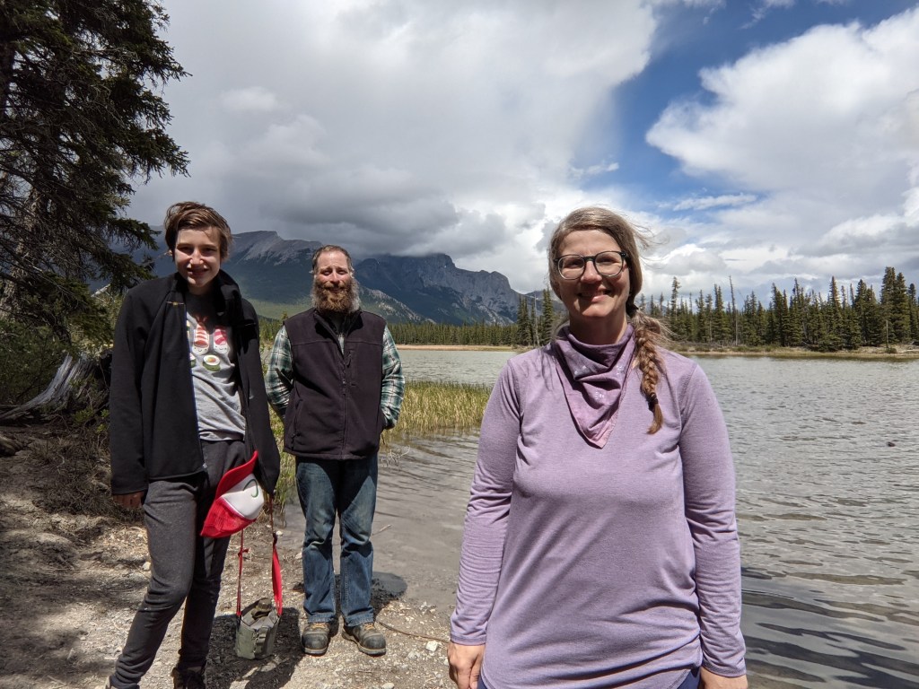
Lucas doesn’t love hiking because there are no cars to ogle on the trail. But seriously, he is a trooper, and only started asking “how much longer” when we were all thinking that. When we told him we were on the way back to the car, well, that was the fastest I’d seen him walk all day! He carries his own water canteen, stops when he needs to, and thanks to many years of hiking in the mountains, does a great job on the more technical spots.
AND FINALLY
This day was loads of fun. I would love to do more day trips this summer, but will most likely stick closer to Edmonton. The mountains are lovely, but when we only have one driver, it makes more sense to keep the drive time to around 2 hours or less.
These are the traditional and contemporary lands of the Tsuu Tina, Niitsitpiis-Stahkoli (Blackfoot), Ktunaxa Nation Yagan Nukiy (Kootenay), and the Metis Nation. Clearwater County is in Treaty Six.
